Zurginia
| This page is a work in progress by its author(s) and should not be considered final. |
| The People's Scientific Republic of Zurginia Previously known as:
|
|||||
|---|---|---|---|---|---|
|
|||||
| Motto: "Scientia Est Potentia."
"Knowledge is Power." |
|||||
| Anthem: "The Internationale" (Instrumental) | |||||
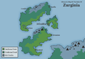
 Location of Zurginia (Dark Green)
|
|||||
| Region | Realm of Unrestricted Science | ||||
| Capital and largest city | Mimbles | ||||
| Official languages | English | ||||
| Demonym | Zurginian | ||||
| Government | Single-party Socialist State | ||||
| - | Administrator | ||||
| Legislature | Parliament | ||||
| History | |||||
| - | Independence (NL) | 1709 CE | |||
| - | Independence (GB) | 1712 CE | |||
| - | Rise of Empire | 1790 CE | |||
| - | Revolution | 1920 CE | |||
| - | ROUS Entry | 1992 CE | |||
| Population | |||||
| - | 2014 estimate | 2,235,000,000 | |||
| GDP (nominal) | 2014 estimate | ||||
| - | Total | 7,520,000,000,000 (NSD) | |||
| - | Per capita | 3,365 (NSD) | |||
| Gini (2012) | low |
||||
| HDI (2014) | medium |
||||
| Currency | Zurginian Digital Pound (£Z) |
||||
| Time zone | ROUS Western Standard | ||||
| Date format | dd ˘ mm ˘ yyyy | ||||
| Drives on the | left | ||||
| Calling code | +472 | ||||
| ISO 3166 code | ZG | ||||
| Internet TLD | .zg, .srz | ||||
| a. | All economic figures extracted from NS tracker. | ||||
| b. | HDI from the Nationstates 'Human Development Index' census. | ||||
| c. | GINI calculated using 1-(income equality census result/{2*mean income equality census result}) | ||||


Zurginia (zʌrɡɪniə), officially The People's Scientific Republic of Zurginia, is a sovreign state located on the Isles of Zurginia, off the North-West coast of the Earth-Based mainland of the Realm of Unrestricted Science, which the country has been a member of since February 1992. Zurginia is a semi-democratic single-party state, which has been governed by the Trotskyist Division of the Zurginian Socialist Party, or ZSP, since 1990. in the capital city of Mimbles, Administrative District, who have governed Zurginia since the overthrow of the Zurginian Imperial Family in 1920. The government follows a form of Socialism with a strictly planned economy, and a semi-democratic political system.
As private enterprise is banned, the entire working population of Zurginia is employed in the public sector, mostly in the fields of Scientific Research, Education, Medicine, and IT work. This focus on scientific and technological advancement has resulted in a highly educated population, and a huge amount of scientific discovery, however, this has come at the cost of a weak and unstable economy, and a low GDP per Capita. Most of the country's income comes from tourism from around the world, particularly the ROUS. Zurginia is amongst the world's most popular tourist destinations, due to its large areas of untouched wilderness on the North and South Isles.
Zurginia was formed in 1712 from the union of the newly independent former British Zurginia (now the North Isle and Mimbles Island), and former Dutch Zurginia (now the South Isle), which gained independence in 1712 and 1709, respectively, following the Zurginian War of Independence.
Contents
Etymology & Terminology
The exact origin of the name Zurginia is somewhat unclear. Before the first British and Dutch settlers began arriving on the islands in the 16th and 17th centuries, the islanders (who are believed to be descended from Scandinavian settlers from 500-700 years earlier) had already taken to calling themselves the skógr-þjóð meaning people of the forest in Old Norse. Due to having difficulty pronouncing this, the settlers began to refer to them as the Zurk. Zurginia is believed to be a corruption of this, making it's meaning Land of the Zurk.
The People's Scientific Republic of Zurginia, generally referred to as Zurginia, the Republic of Zurginia, or the SRZ, is the sovreign state which occupies the Isles of Zurginia. The Isles of Zurginia is a geographic region as opposed to a political one.
History
Industrial Era (1712 - 1790)
Following the full independence of the Isles of Zurginia, (The South Isle from The Netherlands in 1709, and The North Isle and Mimbles Island from Great Britain in 1712), The Kingdom of Zurginia was established. The following years saw massive industrialisation of Mimbles Island.
Imperial Era (1790 - 1920)
Following the successful industrialisation of Zurginia, the Islands began using their technological advantage to conquer several islands around the north-western coast of the present day ROUS, and some small areas of the mainland. The majority of the colonies were however, given independance following the toppling of the emperor in 1920.
Revolutionary Era (1920 - 1945)
Following the rise of communism in the early 20th century, the Zurginian Bolshevik League (now the ZSP), staged a revolution, beginning in march 1920, on Mimbles island. By July of 1920, the revolution had overthrown the Royalist Army, and removed the Emperor from office. Following widespread public support of the revolutionaries, a new government was established, with Hugo von Bwuttstein Jr as it's Administrator.
Cold War (1945 - 1991)
Following the end of the second world war, with the growing tension between the USSR and USA, Zurginia aligned itself with the Soviet Union, on grounds of shared ideology. This created tension between Zurginia and some members the ROUS.
Scientific Era (1991-present)
Following the break up of the Soviet Union between 1985 and 1991, tensions eased between Zurginia and the Realm Of Unrestricted Science, which Zurginia became a full member of in 1992, ushering in a new era of scientific discovery, and collaboration. This collaboration eventually resulted in Zurginia's first moon landing in 1998, and the subsequent moon landings throughout the late twentieth and twenty first centuries, resulting in the New Londor Moon Base. In 2006, Zurginia completed the Zurginia National Space Station, which is home to 6-12 cosmonauts and scientists at a time.

Moon Mission (1998)

Geography
Zurginia is a mountainous, heavily forested nation, with the vast majority of the land almost completely uninhabited. 61% of the population live on Mimbles Island, which only accounts for around 10% of Zurginia's land area. The North and South Isles are far more sparsely populated, and are home to 29% and 10% of the population respectively. Most of the north and south islands are primarily covered by deciduous forest, and coniferous forest along the northern coasts of both islands.
Climactic Map Of Zurginia
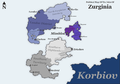
Political Map of Zurginia
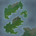
Satellite Map of Zurginia


People
Population
Zurginia has an approximate population of 2,235,000,000, as of February 2014. The majority of this population live on Mimbles Island, which is far more urbanised than the other two islands. Most of the population are descended from the 16th/17th century European Settlers (Most of whom were British or Dutch), and the earlier Scandinavian settlers.
Since then, Zurginia has seen large-scale immigrations from around the world, particularly from around the Central and Eastern Europe, and South America, mostly during the early and mid twentieth century. Since 1991, many migrants have come to Zurginia from the Realm of Unrestricted Science.
Languages
Religion
Education
Culture
National Symbols
The national animal of Zurginia has long been the Red Squirrel, was first officially acknowledged in 1790 on the full imperial flag, however, there are records of its use on banners and standards since the 14th century. The same is true of the national colours of purple, black, and white. The first official flag of the unified Zurginia was the Imperial standard; a black-bordered white Scandinavian Cross on a purple Field. This flag was sometimes displayed with the emblem of the red squirrel in white in the top left corner.
Since 1920, the primary symbol of Zurginia has been the Hammer and Sickle inside a Gear. This was first used in 1919 by the Zurginian Bolshevik League, (now known as the Zurginian Socialist Party). It represents the unity of Socialism and Technological advancement that is key to the ideology of Zurginia. This symbol also appears on the Zurginian Pound, alongside Zurginian historical figures, famous scientists, and socialist thinkers.

Imperial Flag Primary (1790 - 1920)

Imperial Flag Variant (1790 - 1920)

Socialist Party Flag
(1920 - 2014)
Socialist Party Flag
(2014 - present)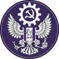
Socialist Party Seal
(1920 - present)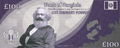
Note Depicting Karl Marx
(2007 Series)


Science & Technology
Politics
Zurginia's central government is made of 144 Members of Parliament, including 8 Regional Chairpeople, 10 Ministers, The Deputy Administrator, and The Administrator. The government meets in Mimbles.
The Isles of Zurginia are divided up into eight districts, each of which is governed by a District Council, who are responsible for the area's regulation and law enforcement, however, these councils have no power to change laws, and the Central Administration (Based in Mimbles, Administrative District) can overrule any decision made by local authorities.
| District | Capital City | Largest City | Population (2014 est.) | Density (2014 est.) |
|---|---|---|---|---|
Administrative District 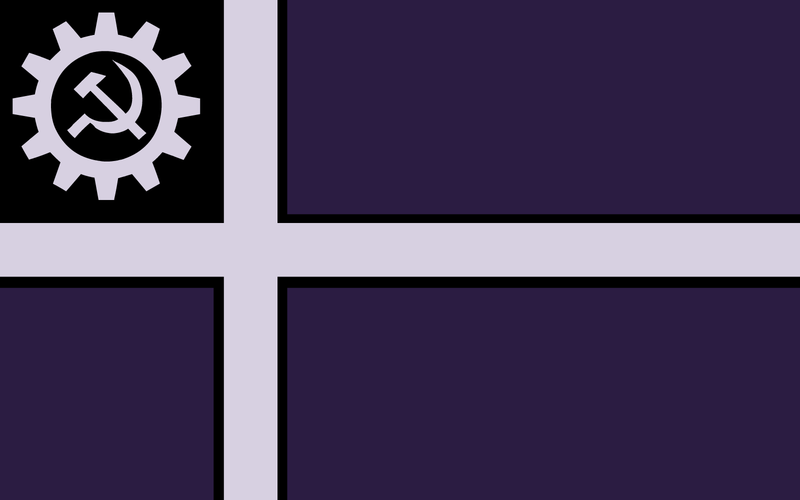
|
Mimbles | Mimbles | 1072800000 | 5,857/km2 |
West Mimbles 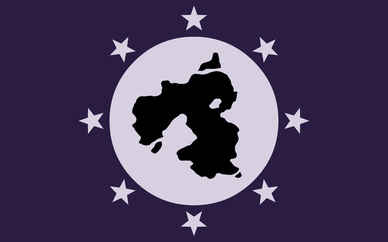
|
Rothens | Angcow | 280550000 | 3,112/km2 |
Londor District 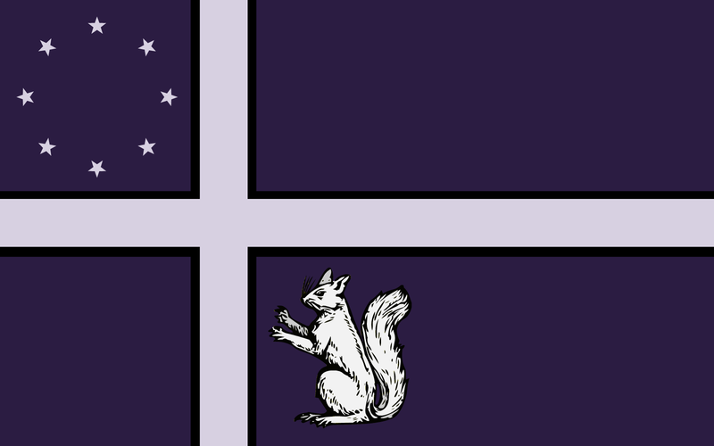
|
Londor | Londor | 245850000 | 512/km2 |
Southern Territory 
|
Beldrid | Beldrid | 201150000 | 401/km2 |
North Zurginian Territory 
|
Harome | Morlin | 111750000 | 112/km2 |
Eriadam District 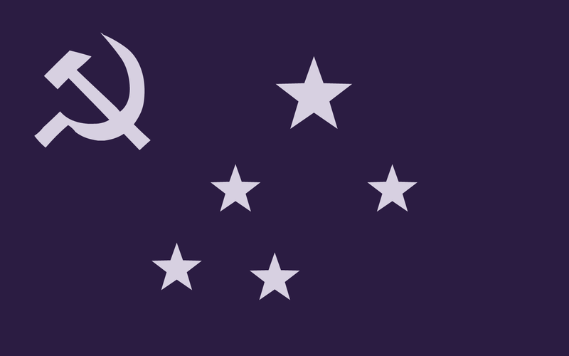
|
Eriadam | Eriadam | 89400000 | 241/km2 |
South-Parhan District 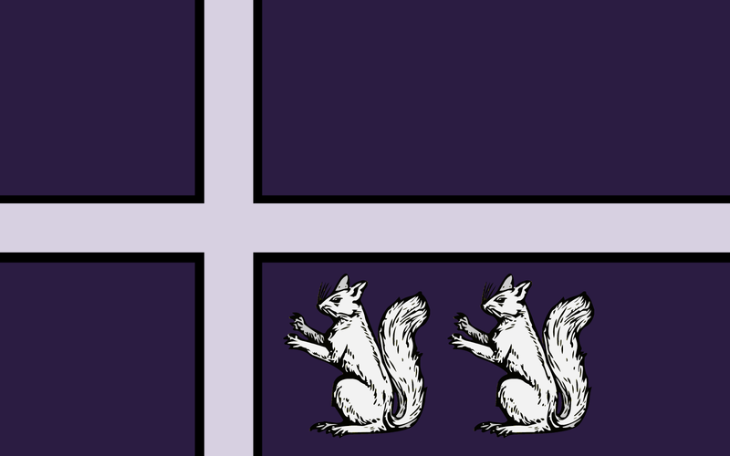
|
Parhan | Parhan | 89400000 | 290/km2 |
Southern Highlands 
|
New Arnfast | New Arnfast | 67050000 | 91/km2 |
| Overseas Territories | N/A | N/A | 357600000 | 291/km2 |
Economics
Table of government expenditure during 2013.
| Department | Budget (£Z) | Budget (NSD) | Percentage Total |
|---|---|---|---|
| Education | 841256000000 | 73430000000 | 22% |
| Environment | 688300000000 | 60080000000 | 18% |
| Social Equality | 688300000000 | 60080000000 | 18% |
| Welfare | 420628000000 | 36710000000 | 11% |
| Healthcare | 382389000000 | 33380000000 | 10% |
| Law & Order | 344150000000 | 30040000000 | 9% |
| Public Transport | 191195000000 | 16690000000 | 5% |
| Administration | 152956000000 | 13350000000 | 4% |
| Industry | 76478000000 | 6680000000 | 2% |
| Defense | 38239000000 | 3340000000 | 1% |
| Spirituality | 0 | 0 | 0% |
