File:Eslanish Territories.png
From NSWiki

Size of this preview: 800 × 435 pixels. Other resolution: 3,500 × 1,904 pixels.
Original file (3,500 × 1,904 pixels, file size: 497 KB, MIME type: image/png)
Summary
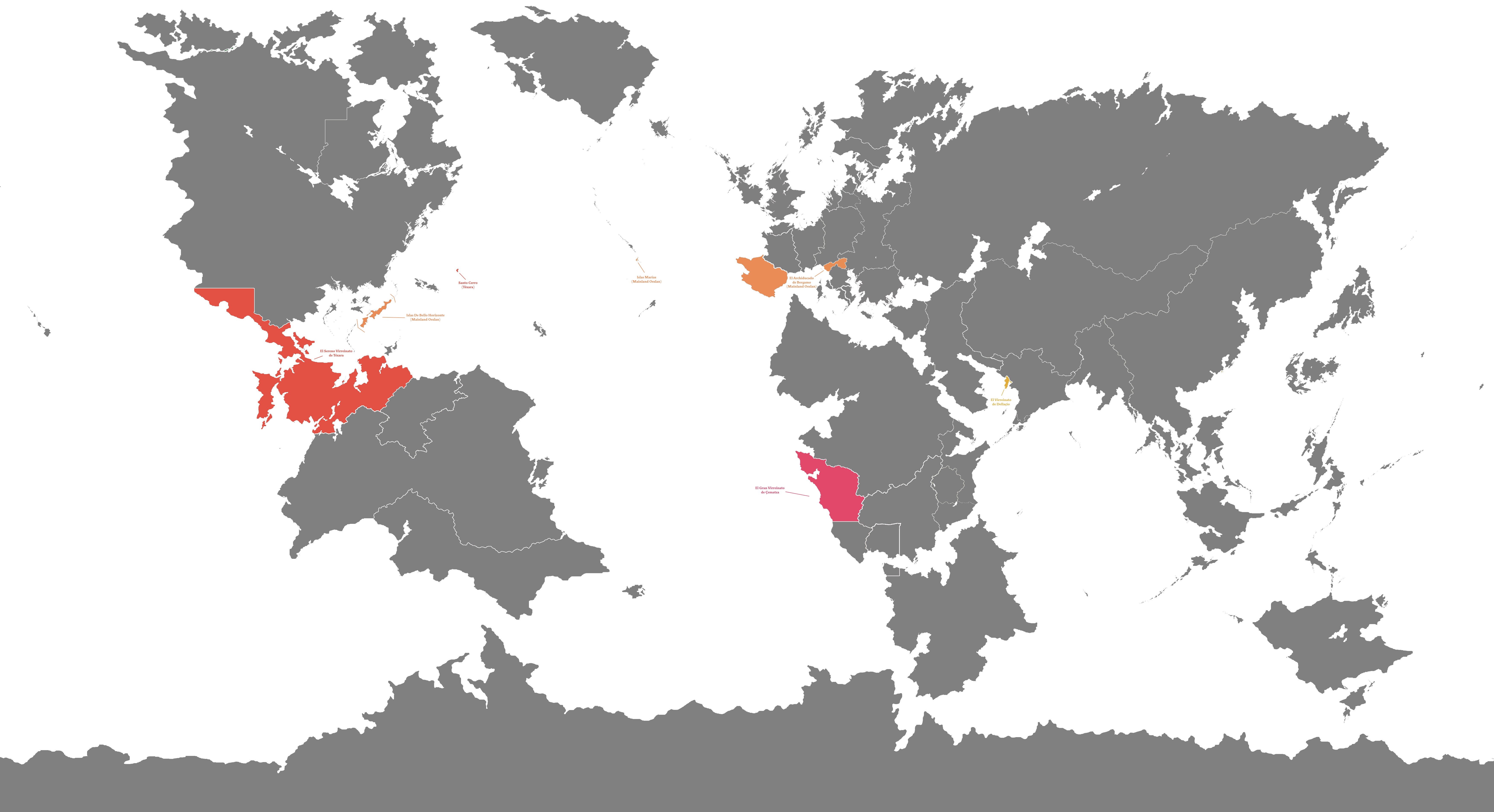
This is a map of the oversea territories of Oeslan.
This map is colour-coded by the territory to which its jurisdiction falls under:
Mainland Oeslan and the non-contiguous territories falling under the former's jurisdiction.
The Serene Viceroyalty of Téxara (Eslanish: La Serenísima Virreinato del Téxara)
The Grand Viceroyalty of Çematza (Eslanish: El Gran Virreinato de Çematza)
The Serene Viceroyalty of Dellaçío (Eslanish: El Virreinato de Dellaçío)
File history
Click on a date/time to view the file as it appeared at that time.
| Date/Time | Thumbnail | Dimensions | User | Comment | |
|---|---|---|---|---|---|
| current | 18:30, 25 October 2015 | | 3,500 × 1,904 (497 KB) | Oeslan (Talk | contribs) | |
| 18:28, 25 October 2015 | 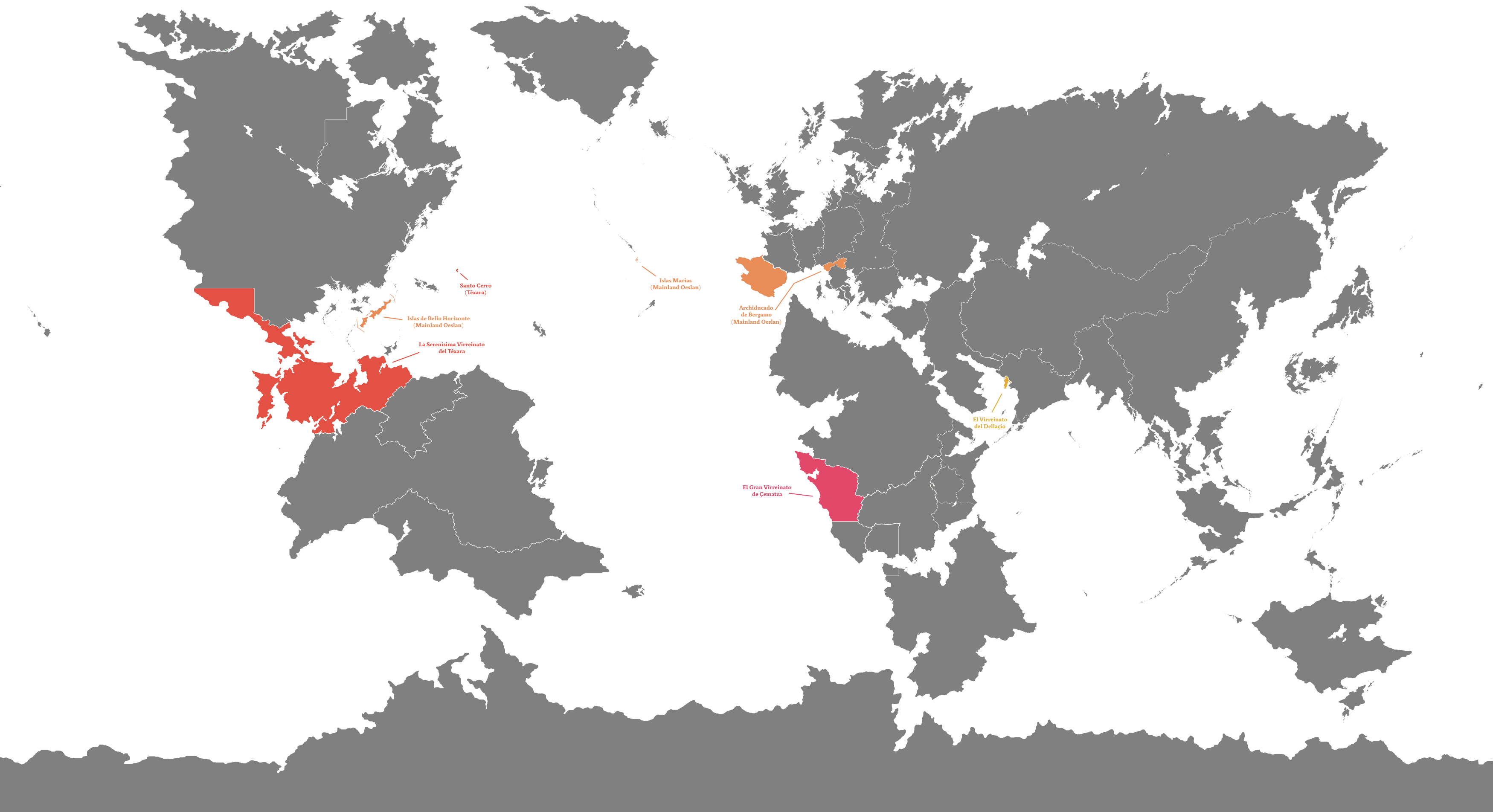 | 3,500 × 1,904 (427 KB) | Oeslan (Talk | contribs) | ||
| 17:56, 25 October 2015 | Error creating thumbnail: Invalid thumbnail parameters | 7,000 × 3,807 (842 KB) | Oeslan (Talk | contribs) |
- You cannot overwrite this file.
File usage
The following page links to this file:
