Zurginia
| This page is a work in progress by its author(s) and should not be considered final. |
| The People's Scientific Republic of Zurginia Previously known as:
|
|||||
|---|---|---|---|---|---|
|
|||||
| Motto: "Scientia Est Potentia."
"Knowledge is Power." |
|||||
 Isles of Zurginia
|
|||||
| Region | Realm of Unrestricted Science | ||||
| Capital and largest city | Mimbles | ||||
| Official languages | English | ||||
| Demonym | Zurginian | ||||
| Government | Single Party Socialist State | ||||
| - | Administrator | Dr. Zephaniah Zedd (ZSP) | |||
| History | |||||
| - | Independence | 1712 | |||
| - | Rise of Zurginian Empire | 1790 | |||
| - | Socialist Revolution | 1920 | |||
| Population | |||||
| - | 2014 estimate | 2,235,000,000 | |||
| GDP (nominal) | 2014 estimate | ||||
| - | Total | 7,520,000,000,000 (NSD) | |||
| - | Per capita | 3,365 (NSD) | |||
| Currency | Zurginian Pound (£Z) |
||||
| Time zone | ROUS Standard | ||||
| Date format | dd ˘ mm ˘ yyyy | ||||


Zurginia (zʌrɡɪniə), officially The People's Scientific Republic of Zurginia, is a sovreign state located in the Realm of Unrestricted Science. Zurginia is a single-party state, governed by the Zurginian Socialist Party, or ZSP. The nation is notable, primarily, for its utmost devotion to scientific and technological advancement, as well as its outstanding natural beauty.
Contents
History

Imperial Flag Primary (1790 - 1920)

Imperial Flag Variant (1790 - 1920)

Socialist Party Flag
(1920 - present)
Socialist Party Seal
(1920 - present)


Imperial Era (1790 - 1920)
Revolutionary Era (1920 - 1945)
Following the rise of communism in the early 20th century, the Zurginian Bolshevik League (now the ZSP), staged a revolution, beginning in march 1920, on Mimbles island. By July of 1920, the revolution had overthrown the Royalist Army, and removed the Emperor from office.
Cold War (1945 - 1991)
Scientific Era (1991-present)
Geography

Zurginia is a mountainous, heavily forested nation, with the vast majority of the land almost completely uninhabited. 61% of the population live on Mimbles Island, which only accounts for around 10% of Zurginia's land area. The North and South Isles are far more sparsely populated, and are home to 29% and 10% of the population respectively. Most of the north and south islands are primarily covered by deciduous forest, and coniferous forest along the northern coasts of both islands.
Politics


Zurginia's central government is made of 144 Members of Parliament, including 8 Regional Chairpeople, 10 Ministers, and The Administrator. The government meets in Mimbles.
The Isles of Zurginia are divided up into eight districts, each of which is governed by a District Council, who are responsible for the area's regulation and law enforcement, however, these councils have no power to change laws, and the Central Administration (Based in Mimbles, Administrative District) can overrule any decision made by local authorities.
| District | Capital City | Largest City | Population (2014 est.) | Density (2014 est.) |
|---|---|---|---|---|
Administrative District 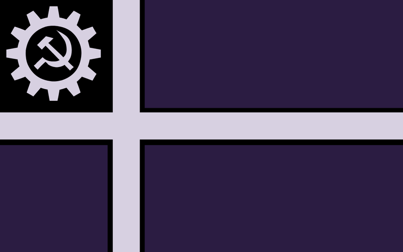
|
Mimbles | Mimbles | 1072800000 | 5,857/km2 |
West Mimbles 
|
Rothens | Angcow | 280550000 | 3,112/km2 |
Londor District 
|
Londor | Londor | 245850000 | 512/km2 |
Southern Territory 
|
Beldrid | Beldrid | 201150000 | 401/km2 |
North Zurginian Territory 
|
Harome | Morlin | 111750000 | 112/km2 |
Eriadam District 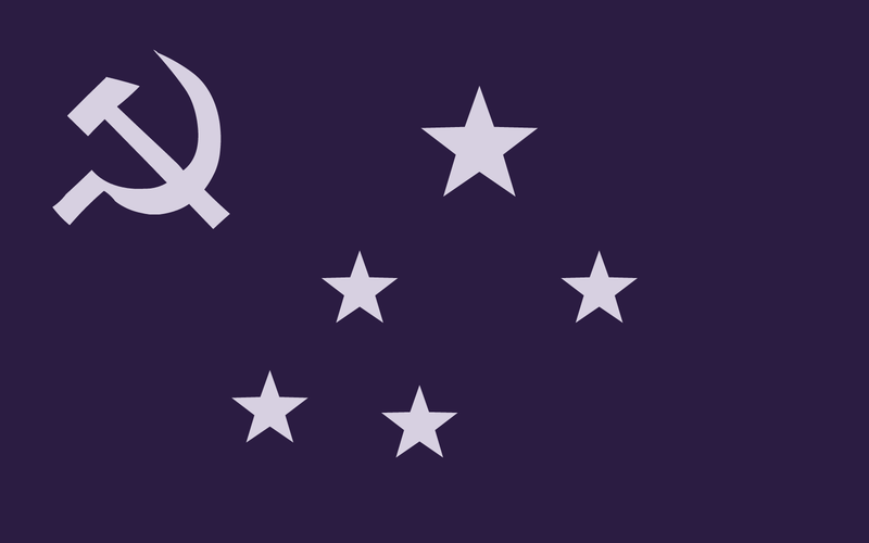
|
Eriadam | Eriadam | 89400000 | 241/km2 |
South-Parhan District 
|
Parhan | Parhan | 89400000 | 290/km2 |
Southern Highlands 
|
Arnfast | Arnfast | 67050000 | 91/km2 |
| Overseas Territories | N/A | N/A | 357600000 | 291/km2 |
