Difference between revisions of "Kernansquillec"
m |
(Geography) |
||
| Line 28: | Line 28: | ||
|established_event2 = [[History_of_Kernansquillec#The_Saviors_of_Kernanski_.281328_-_1378.29|Reunification]] | |established_event2 = [[History_of_Kernansquillec#The_Saviors_of_Kernanski_.281328_-_1378.29|Reunification]] | ||
|established_date2 = 6th February 1378 | |established_date2 = 6th February 1378 | ||
| − | |established_event3 = [[History_of_Kernansquillec#The_First_Kernansquillecan_War_.281735_-_1743.29|The First | + | |established_event3 = [[History_of_Kernansquillec#The_First_Kernansquillecan_War_.281735_-_1743.29|The First Republic]] |
|established_date3 = 10th October 1743 | |established_date3 = 10th October 1743 | ||
|established_event4 = [[History_of_Kernansquillec#The_Second_Kernansquillecan_War_.281762_-_1765.29|The Second Republic]] | |established_event4 = [[History_of_Kernansquillec#The_Second_Kernansquillecan_War_.281762_-_1765.29|The Second Republic]] | ||
| Line 71: | Line 71: | ||
|iso3166code = KRN | |iso3166code = KRN | ||
}} | }} | ||
| − | '''Kernansquillec''' (''[kɜ:ʳnoʊnski:jek]''), officially the '''Parliamentary Republic of Kernansquillec''' (French: ''République Parlementaire de Kernansquillec'' [ʁepyblik paʁləmɑ̃tɛʁ də kɜ:ʳnoʊnski:jek]), is a sovereign state comprising territory in south western [[region/Rushmore|Ruhsmore]]. Kernansquillecan territory extends from Lac Oranga and Uzekia to the Goose Sea, from Civil Citizenry to the former territories of Mangolana. Kernansquillec spans 1,976,986 km² (763,318 sq mi) and has a total population of 301.3 million. It is a unitary parliamentary republic with the capital in Kernansquillec City, the country's largest city and commercial hub. | + | '''Kernansquillec''' (''[kɜ:ʳnoʊnski:jek]''), officially the '''Parliamentary Republic of Kernansquillec''' (French: ''République Parlementaire de Kernansquillec'' [ʁepyblik paʁləmɑ̃tɛʁ də kɜ:ʳnoʊnski:jek]), is a sovereign state comprising territory in south western [[region/Rushmore|Ruhsmore]]. Kernansquillecan territory extends from Lac Oranga and [[Uzekia]] to the Goose Sea, from [[Civil Citizenry]] to the former territories of [[Mangolana]]. Kernansquillec spans 1,976,986 km² (763,318 sq mi) and has a total population of 301.3 million. It is a unitary parliamentary republic with the capital in [[Kernansquillec City]], the country's largest city and commercial hub. |
The first humans to live in the modern-day region of Kernansquillec are believed to have arrived around 2500[[History_of_Kernansquillec#Prehistory_.28cerca._2500BT_-_0PT.29|BT]]. Settlements began to develop from the end of the Prehistoric Era and by the 6th century most of Kernansquillec was divided into a large system of city-states. An actual unified country covering the territory of modern-day Kernansquillec would only emerge with the [[History_of_Kernansquillec#The_Unification_of_Kernansquillec_.28814_-_853.29|Kernak Era]]. Following the conquests of Kernak I and his son, Kernak II, a nation - by the name of Kernakàn - was founded on the 23rd November 853. | The first humans to live in the modern-day region of Kernansquillec are believed to have arrived around 2500[[History_of_Kernansquillec#Prehistory_.28cerca._2500BT_-_0PT.29|BT]]. Settlements began to develop from the end of the Prehistoric Era and by the 6th century most of Kernansquillec was divided into a large system of city-states. An actual unified country covering the territory of modern-day Kernansquillec would only emerge with the [[History_of_Kernansquillec#The_Unification_of_Kernansquillec_.28814_-_853.29|Kernak Era]]. Following the conquests of Kernak I and his son, Kernak II, a nation - by the name of Kernakàn - was founded on the 23rd November 853. | ||
| Line 92: | Line 92: | ||
''Main Article: [[History of Kernansquillec]]'' | ''Main Article: [[History of Kernansquillec]]'' | ||
| − | + | After the most recent conflict in Kernansquillecan history, many historical records were destroyed. But after much research, many records have now been restored and historical research is a booming field of study in Kernansquillecan universities. | |
| − | [...] | + | ===Prehistory=== |
| + | ''Main Article: [[History_of_Kernansquillec#Prehistory_.28cerca._2500BT_-_0PT.29|Prehistoric Era in Kernansquillec]]'' | ||
| + | |||
| + | The Prehistory Period is defined as the period that precedes the start of the construction of a true Kernansquillecan state and is generally considered to have ended once a written trace of time keeping was discovered in the year zero. The first traces of man settling in Kernansquillec date back to around 2500BT with the oldest traces, wall paintings in a cave, being found close to Lac Oranga in Northern Kernansquillec. As the number of human communities sprung up, eventually a "southern push" took place, with many communities moving to the southern and western parts of the land. By 1600BT experts believe that most of Kernansquillec's south coast had human settlements that had started to farm and build huts. | ||
| + | |||
| + | Progress was being made fast by these first Kernansquillecans. Estimate put the population of Kernansquillec around 750BT at about 80 000 individuals. The end of the prehistoric period is marked by the development of written and spoken language. The Kernansquillecan language evolved from primitive grunts to audible words and even phrases by 750BT and by 200BT a rich vocabulary had evolved and the first written words even started to emerge. Some evidence shows that a form of schooling had even evolved in certain tribes to the west of Kernansquillec by 150BT. | ||
| + | |||
| + | ===The Building of a Nation=== | ||
| + | ''Main Article: [[History_of_Kernansquillec#The_Building_of_a_Nation_.280_-_1030.29|The rise of Kernakàn]]'' | ||
| + | |||
| + | ===The Dark Ages=== | ||
| + | ''Main Article: [[History_of_Kernansquillec#The_Dark_Ages_.281030_-_1735.29|The Dark Ages in Kernansquillec]]'' | ||
| + | |||
| + | ===The Struggle for Democracy=== | ||
| + | ''Main Article: [[History_of_Kernansquillec#The_Struggle_for_Democracy_.281735_-_1765.29|The Birth of the First and Second Republics]]'' | ||
| + | |||
| + | ===Reconstruction and Democracy=== | ||
| + | ''Main Article: [[History_of_Kernansquillec#Reconstruction_and_Democracy_.281765_-_2017.29|Life under the Second Republic]]'' | ||
| + | |||
| + | ===A Modern Tragedy=== | ||
| + | ''Main Article: [[History_of_Kernansquillec#A_Modern_Tragedy_.282017_-_2056.29|The Great War]]'' | ||
| + | |||
| + | ===Contemporary period=== | ||
| + | ''Main Article: [[History_of_Kernansquillec#Present_Day_.282056_-_today.29|Present-day Kernansquillec]]'' | ||
==Geography== | ==Geography== | ||
| − | + | ===Location and borders=== | |
| + | Kernansquillec is located in the Goose Coast region of South-West Rushmore. It is bordered by [[Civil Citizenry]] and [[Astograph]] in the West, [[Uzekia]] and [[Djocoranga]] in the North and by the former territories of [[Mangolana]] in the East. In the south Kernansquillec is bordered by the Blue Sea and the Goose Sea and also has maritime border with the Hemula Islands of [[Olastor]]. | ||
| + | |||
| + | Kernansquillec has a land mass of 1,976,986 km² (763,318 sq mi) comprised for the most part in the mainland, while the islands of Big Island, Île du Bleu and Capitol Island make up the rest. With its island possessions Kernansquillec possesses territorial waters covering 4,629,231 km² (1,787,356 sq mi) and has an exclusive economic zone covering 28,254,329 km² (10,909,057 sq mi). | ||
| + | |||
| + | Located within central Kernansquillec and at 4,126.52 meters (13,538 feet) above sea level, Mont Kate is the tallest point in the country. Kernansquillec also has extensive river systems, most notably the Faisan, the Gingère and the Tissier. | ||
===Climate=== | ===Climate=== | ||
| − | Kernansquillec has a fairly temperate climate though it does chance throughout the country. Along the South Coast the climate is much warmer, with the temperatures usually well into the mid | + | Kernansquillec has a fairly temperate climate though it does chance throughout the country. Along the South Coast the climate is much warmer, with the temperatures usually well into the mid to high twenties during the summer. Central Kernansquillec is much cooler in general, especially around the mountain range that runs from south-west of the city of Mont Kate up to the south of Mur-de-Kernansquillec. There is also a much smaller mountain range in central Big Island that often causes heavy downfalls during Spring. |
| + | |||
| + | Across Kernansquillec average temperatures range from -6°C to 5°C during the winter months up to 17°C to 26°C during peak summertime. Rainfall follows a similar pattern with around 100mm during the winter months, while the summer sees about half as much. | ||
| − | + | ===Environment and Wildlife=== | |
| + | Kernansquillec is generally considered to be one of the most environmentally friendly countries in Rushmore with the country having turned carbon-neutral since 2046. With it clean, fresh air, beautiful landscapes and clean natural water, it has significantly develop a large tourism sector despite the weather hardly being one of a paradise. Strict business regulations, public policies and law enforcement has allowed for a balance to be found between economic production and environmental protection. | ||
| − | + | Thanks to these efforts, wildlife has thrived. Amateur and recreational hunting has been banned since 1822, while the first national parks were created in 1492. Kernansquillec is an animal loving nation with over half of households owning a pet. Animals and wildlife are well looked after, with violence against animals dealt with in a harsh manner. Animals have had their own separate judicial status since 1910 allowing crimes to be punished in manner that often are barely different from similar crimes against humans. | |
| − | + | ||
| − | = | + | <gallery mode=packed> |
| − | + | File:Kernansquilllec_City_Coast.jpg| The coast line in Kernansquillec City | |
| + | File:Kernansquillecan horses.jpg|Kernansquillecan horses roaming in the wild in the Menezer region | ||
| + | File:Coast Big Island.jpg| An isolated cove on Big Island | ||
| + | File:Wheat_field_near_Binic.jpg| A wheat field near Binic | ||
| + | File:Winter_in_the_Katines.jpg| Winter in the Katines Mountains | ||
| + | </gallery> | ||
==Demographics== | ==Demographics== | ||
Revision as of 16:30, 9 July 2016
| This page is a work in progress by its author(s) and should not be considered final. |
| The Parliamentary Republic of Kernansquillec
|
|||||
|---|---|---|---|---|---|
|
|||||
| Motto: "Force, Liberté et Honneur." "Strength, Freedom and Honor." |
|||||
| Anthem: "Hills of the Motherland" | |||||
 Kernansquillec in the Gold Coast (Rushmore)
|
|||||
| Region | Rushmore | ||||
| Capital and largest city | Kernansquillec City | ||||
| Official languages | English, French | ||||
| Demonym | Kernansquillecan | ||||
| Government | Parliamentary Republic | ||||
| - | Prime Minister | Daina Leonardsson (Dem) | |||
| - | The Peoples' President | Brandee Danniell (Vox) | |||
| Legislature | The House of the People | ||||
| - | Upper house | The Hall of Elected | |||
| - | Lower house | The Peoples' Senate | |||
| History | |||||
| - | Kernakàn unified | 23rd November 881 | |||
| - | Reunification | 6th February 1378 | |||
| - | The First Republic | 10th October 1743 | |||
| - | The Second Republic | 15th June 1765 | |||
| - | Currant Republic | 1st July 2032 | |||
| Area | |||||
| - | Total | 1,976,986 km2 763,318 sq mi |
|||
| - | Water (%) | 2.3% | |||
| Population | |||||
| - | 2070 estimate | 301,296,931 | |||
| - | Density | 152.40/km2 394.7/sq mi |
|||
| GDP (nominal) | 2070 estimate | ||||
| - | Total | N$D 16.648 trillion (₭ 10.400 trillion) |
|||
| - | Per capita | N$D 55,257.50 (₭ 34,510.68) |
|||
| Gini (2070) | 0.070 low |
||||
| HDI (2070) | 0.848 very high |
||||
| Currency | The Urbk (₭) | ||||
| Time zone | Branta Time (UTC+1) | ||||
| Date format | dd/mm/yyyy | ||||
| Drives on the | left | ||||
| Calling code | 22 | ||||
| ISO 3166 code | KRN | ||||
| Internet TLD | .krn | ||||


Kernansquillec ([kɜ:ʳnoʊnski:jek]), officially the Parliamentary Republic of Kernansquillec (French: République Parlementaire de Kernansquillec [ʁepyblik paʁləmɑ̃tɛʁ də kɜ:ʳnoʊnski:jek]), is a sovereign state comprising territory in south western Ruhsmore. Kernansquillecan territory extends from Lac Oranga and Uzekia to the Goose Sea, from Civil Citizenry to the former territories of Mangolana. Kernansquillec spans 1,976,986 km² (763,318 sq mi) and has a total population of 301.3 million. It is a unitary parliamentary republic with the capital in Kernansquillec City, the country's largest city and commercial hub.
The first humans to live in the modern-day region of Kernansquillec are believed to have arrived around 2500BT. Settlements began to develop from the end of the Prehistoric Era and by the 6th century most of Kernansquillec was divided into a large system of city-states. An actual unified country covering the territory of modern-day Kernansquillec would only emerge with the Kernak Era. Following the conquests of Kernak I and his son, Kernak II, a nation - by the name of Kernakàn - was founded on the 23rd November 853.
The unified nation would not last however. By the turn of the millennium a Dark Age had set upon the land as Kernakàn was split in two: northern Oranges and southern Kernanski. The division between the two halves would remain in place until 1378 when an actual nation called Kernansquillec was born. The price for unity was high however, as the nation became subdued by a radical theological regime known as the Saviors. The regime would last until the mid-18th century when a new struggle was born: the fight for democracy. Two civil wars would follow one another, but the 1st October 1765, the constitution of the Second Parliamentary Republic of Kernansquillec was sighed by Kernansquillec's new Prime Minister, Benjamin Orinda.
Kernansquillec was developed at a fast pace afterwards and soon became an economic powerhouse in Rushmore. Everything changed in 2020 however as the Great War began. A seemingly stable and prosperous nation was dragged into an eleven year long war that would drain resources and bring the country to the brink of collapse in the fight against Uzekian forces. Victory in July 2031 marked the beginning of the Third Republic and set in motion the construction of today's Kernansquillec.
Since the rise of the First Republic, Kernansquillec's cultural and economic influence in Rushmore has grown. Kernansquillec is one of the most popular destinations for foreign visitors in Rushmore with an estimated 145 million tourists arriving every year. Kernansquillec is a developed economy, producing an estimated 16.648 trillion N$D worth of GDP per year, while managing to keep a very high level of living for all citizens. Kernansquillec is famed for its incredibly low Gini coefficient with the divide between rich and poor greatly reduced thanks to ambitious taxation policies. Kernansquillec also performs well in terms of welfare spending, public education and eco-friendliness.
Kernansquillec is a well respected power in the world. It is a member of the World Assembly and of the Security Council. Kernansquillec also has a developped military force of over 233,000 personnel.
Contents
Etymology
Kernansquillec's name is derived from the name of the first country to be formed on it's mainland, Kernakàn, which in turn was named after it's first King, King Kernak I. Kernakàn then evolved into Kernanski during the Dark Ages before a nation called Kernansquillec was born in 1378. The first mention of the name being used can be dated back to 1303.
Kernansquillec's inhabitants are known as Kernansquillecans while the country's name can be shortened to the trigram KRN, namely for international sporting events such as the Olympic Games or the UICA's Champions' Cup.
History
Main Article: History of Kernansquillec
After the most recent conflict in Kernansquillecan history, many historical records were destroyed. But after much research, many records have now been restored and historical research is a booming field of study in Kernansquillecan universities.
Prehistory
Main Article: Prehistoric Era in Kernansquillec
The Prehistory Period is defined as the period that precedes the start of the construction of a true Kernansquillecan state and is generally considered to have ended once a written trace of time keeping was discovered in the year zero. The first traces of man settling in Kernansquillec date back to around 2500BT with the oldest traces, wall paintings in a cave, being found close to Lac Oranga in Northern Kernansquillec. As the number of human communities sprung up, eventually a "southern push" took place, with many communities moving to the southern and western parts of the land. By 1600BT experts believe that most of Kernansquillec's south coast had human settlements that had started to farm and build huts.
Progress was being made fast by these first Kernansquillecans. Estimate put the population of Kernansquillec around 750BT at about 80 000 individuals. The end of the prehistoric period is marked by the development of written and spoken language. The Kernansquillecan language evolved from primitive grunts to audible words and even phrases by 750BT and by 200BT a rich vocabulary had evolved and the first written words even started to emerge. Some evidence shows that a form of schooling had even evolved in certain tribes to the west of Kernansquillec by 150BT.
The Building of a Nation
Main Article: The rise of Kernakàn
The Dark Ages
Main Article: The Dark Ages in Kernansquillec
The Struggle for Democracy
Main Article: The Birth of the First and Second Republics
Reconstruction and Democracy
Main Article: Life under the Second Republic
A Modern Tragedy
Main Article: The Great War
Contemporary period
Main Article: Present-day Kernansquillec
Geography
Location and borders
Kernansquillec is located in the Goose Coast region of South-West Rushmore. It is bordered by Civil Citizenry and Astograph in the West, Uzekia and Djocoranga in the North and by the former territories of Mangolana in the East. In the south Kernansquillec is bordered by the Blue Sea and the Goose Sea and also has maritime border with the Hemula Islands of Olastor.
Kernansquillec has a land mass of 1,976,986 km² (763,318 sq mi) comprised for the most part in the mainland, while the islands of Big Island, Île du Bleu and Capitol Island make up the rest. With its island possessions Kernansquillec possesses territorial waters covering 4,629,231 km² (1,787,356 sq mi) and has an exclusive economic zone covering 28,254,329 km² (10,909,057 sq mi).
Located within central Kernansquillec and at 4,126.52 meters (13,538 feet) above sea level, Mont Kate is the tallest point in the country. Kernansquillec also has extensive river systems, most notably the Faisan, the Gingère and the Tissier.
Climate
Kernansquillec has a fairly temperate climate though it does chance throughout the country. Along the South Coast the climate is much warmer, with the temperatures usually well into the mid to high twenties during the summer. Central Kernansquillec is much cooler in general, especially around the mountain range that runs from south-west of the city of Mont Kate up to the south of Mur-de-Kernansquillec. There is also a much smaller mountain range in central Big Island that often causes heavy downfalls during Spring.
Across Kernansquillec average temperatures range from -6°C to 5°C during the winter months up to 17°C to 26°C during peak summertime. Rainfall follows a similar pattern with around 100mm during the winter months, while the summer sees about half as much.
Environment and Wildlife
Kernansquillec is generally considered to be one of the most environmentally friendly countries in Rushmore with the country having turned carbon-neutral since 2046. With it clean, fresh air, beautiful landscapes and clean natural water, it has significantly develop a large tourism sector despite the weather hardly being one of a paradise. Strict business regulations, public policies and law enforcement has allowed for a balance to be found between economic production and environmental protection.
Thanks to these efforts, wildlife has thrived. Amateur and recreational hunting has been banned since 1822, while the first national parks were created in 1492. Kernansquillec is an animal loving nation with over half of households owning a pet. Animals and wildlife are well looked after, with violence against animals dealt with in a harsh manner. Animals have had their own separate judicial status since 1910 allowing crimes to be punished in manner that often are barely different from similar crimes against humans.

The coast line in Kernansquillec City
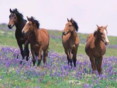
Kernansquillecan horses roaming in the wild in the Menezer region
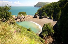
An isolated cove on Big Island
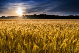
A wheat field near Binic

Winter in the Katines Mountains


Demographics
Population
The latest census dates back to 2059 and estimates the population of Kernansquillec to be 279 953 596. As such, the average density of population per square kilometer is 119.30 (308.99 per sq. mile).
The census also shows a fairly young population, with a demographic gap during the Great War period which took its tole. As such under 18s make up 25% of the population, 18-70 year old's make up 55% of the population, 70-100 year old's 19% and over 100s 1%.
Life expectancy is Linkestimated to be at 87.16 years.
Language
Kernansquillec has to particularity of having two national languages: English and French. As such both are in common use across the country and all students are expected to be fluent in both.
Largest Cities
Kernansquillec's population is largely a city dwelling population with just 30% of the population living in the countryside. In Kernansquillec there are 11 localities to have city status, the largest being the capital with a population of 50 million.
•#1: Kernansquillec City, 50 million •#2: New Southampton, 30 million •#3: Guingamp, 19 million •#4: Rennes, 12 million •#5: Port Marie, 11 million •#6: Binic, 10 million •#7: Mur-de-Kernansquillec, 8 million •#8: Corlay, 7 million •#9: Louargat, 5 million •#10: Mont Kate, 1.5 million •#11: Belle-Isle, 0.9 million
| 2012 rank | City | Province | 2014 estimate | 2011 Census | Change | 2010 land area | 2010 population density |
|---|---|---|---|---|---|---|---|
| 1 | kernansquilllec city | Kernansquillec City | 204,085,649 | 141,451,247 | +9.36% | 10,430km2 | 27,012 per sq mi |
Politics
Government
Law
Foreign Relations
Kernansquillec has a certain amount of international influence. As a World Assembly member Kernansquillec gets to vote and debate resolutions that have an impact on the whole World. The process of reestablishing embassies throughout the World is also well underway.
Kernansquillec's government often seeks out nations that share its democratic and social values for friendly relations while relations with nations with authoritarian, conservative and war-minded regimes are often despised.
Still, it's fair to say that the vast amount of Kernansquillecan international relations are forged on the football pitch and at international sporting tournaments.
Military
The Kernansquillecan Armed Forces are divided into four branches: the Kernansquillecan Infantry (KI), the Kernansquillecan Air Force (KAF), the Kernansquillecan Navy (KerN) and the Kernansquillecan Senior Command (KSenCom). All military operations take place under the supervision of the Prime Minister, the Ministry of Defense and Parliament.
The Kernansquillecan Army has never fought in an overseas conflicts but has been involved in domestic conflicts including the most recent Great War. There currently is an active force of 109 019 soldiers with an additional 236 940 reservists. The bulk of forces is concentrated in the Infantry which has 16 divisions that are posted across Kernansquillec. The Kernansquillecan Army also has 7 air wings and 4 naval squadrons. It must also be noted that Kernansquillec is a nuclear-capable nation.
In 2059 the Ministry of Defense has a budget of N$D 1 477 234 936 000.
