North Slope Tollway
From NSWiki
| North Slope Tollway | |
|---|---|
| Arctic Toll Road | |
| Script error | |
| Route information | |
| Maintained by Jaketon Area Toll Road Authority | |
| Length: | 236.00 mi (379.81 km) |
| Existed: | August 2039 – present |
| Major junctions | |
| West end: | 20pxInterstate 1 south of Barrow, Alaska |
| East end: |
|
| Highway system | |
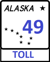
The North Slope Tollway is a toll road that runs for 236 miles (380 km) east–west along the Arctic Coast from Deadhorse to Barrow. The entire toll road is designated as Alaska Toll 49. The toll road is owned and operated by the Jaketon Area Toll Road Authority.
Tolls
Electronic toll gates are located along the freeway which track AlaskaTag users and sends a ticket in the mail to the owner of any car that uses the tollway without a tag. There are AlaskaTag stores in Barrow and Deadhorse.
Service areas
Because of the tollways remoteness, there are service areas located every thirty miles on each side of the freeway. Each service area has a gas station, fast food restaurant, bathroom facilities, and a rest area.
| ||||||||||||||

